


2021
PAPROCANY RESERVOIR
IN TYCHY
Development of the bathing water profile for the Paprocany reservoir in Tychy (ul. Parkowa 17) in accordance with the Regulation of the Minister of the Environment of November 4, 2019, on water profile in bathing water with functional analysis with regard to flood protection, small retention, and recreation – Tychy Municipality – 2017, 2018, and 2021.
As part of the orders, a bathing water profile was prepared and updated. Moreover, an analysis was performed taking into account flood protection aspects, functions related to small water retention, and recreational functions of the reservoir.
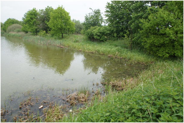
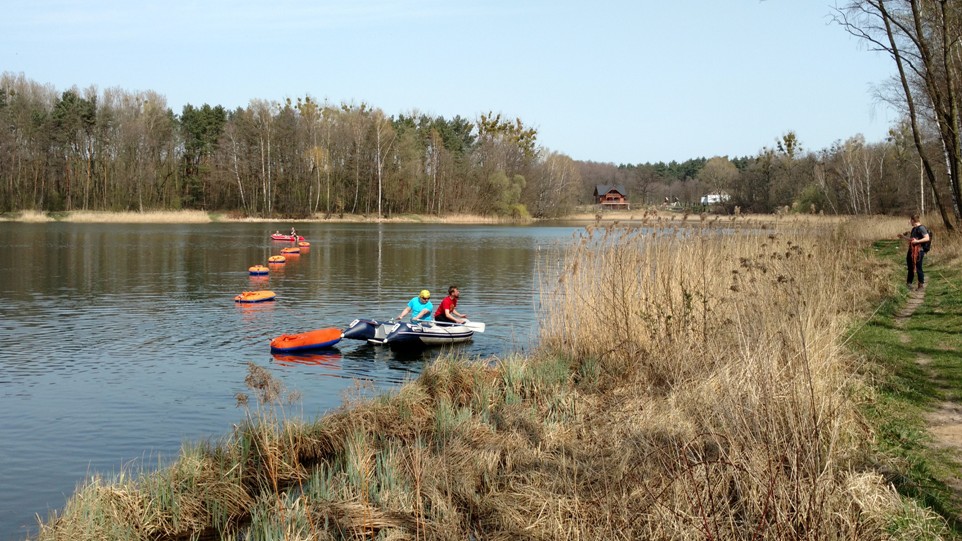
Bathing area on the Paprocany reservoir in Tychy
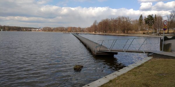
photo by Bartosz Łozowski
photo by Bartosz Łozowski
2020
RESERVOIR IN KOLBARK-KOBYLICA
KLUCZE MUNICIPALITY
Preliminary analysis of the possibilities and assumptions of the concept for the construction of the planned reservoir in Kolbark-Kobylica on the Biała Przemsza River in the Klucze Municipality with a functional analysis with regard to flood protection, small retention, and recreation – Klucze Municipality – 2020.
The subject of the commissioned work was a preliminary analysis of the possibilities and assumptions of the concept for the construction of the planned reservoir in Kolbark-Kobylica on the Biała Przemsza River in the Klucze Municipality with a functional analysis with regard to flood protection, small retention, and recreation (Klucze Municipality, Olkusz Poviat) on 56.8 km of the river Biała Przemsza. Using knowledge-based spatial modelling tools, flood and recreational functions were verified and retention capacity was determined. The effects of the investment were assessed by analysing the changes in the value of ecosystem services provided by the environment and the planned reservoir. It was indicated that the reservoir has a positive influence on local ecosystems, performs an important role in limiting the effects of progressive climate change, increases biodiversity, secures water supply for economic and fire fighting purposes in the municipality. The benefits for the inhabitants of the region, who gain attractive places for recreation, were also indicated. The proposed location of the reservoir was introduced into the spatial development plans of the Klucze Municipality. The next stages of the investment are implemented on the basis of the research performed by the SWC.
SOSINA RESERVOIR
IN JAWORZNO
Performing sonargraphic bathymetric measurements, preparing a bathymetric map of the Sosina reservoir in Jaworzno, and confirming the code of dredged spoil from the removal of sediment from the bottom of the Sosina reservoir in Jaworzno for the implementation of the task entitled ”Reclamation and expansion of the tourist infrastructure of the Sosina reservoir in Jaworzno” – Municipality of the City of Jaworzno – 2020
As part of the commissioned work, bathymetric measurements were made and on their basis, the parameters of the reservoir depth were determined and a 3D reconstruction of the Sosina reservoir bowl (bathymetric map) was performed.
On the basis of the provided laboratory test results, the dredged spoil code was confirmed, indicating that the spoil from the removal of sediment from the Sosina reservoir meets the legal requirements in accordance with the applicable legal acts.
The launch of the UŚka II boat on the Sosina reservoir in Jaworzno and bathymetric measurements on the Sosina reservoir in Jaworzno

photo by Bartosz Łozowski
photo by Bartosz Łozowski
2019
POND 24 BRANDKA, WS-47 BĄCZEK
BYTOM
Qualitative research on an interior basin – Staw 24 Brandka, Ws-47 Bączek in Bytom – Bytom Municipality – 2019.
The subject of the report was the assessment of the condition of the Staw 24 Brandka reservoir, Ws-47 Bączek in Bytom and a preliminary review of the hazards in its catchment area in terms of the specification of essential terms of contract for the modernisation of the interior basin.
Pomiary batymetryczne oraz przygotowanie sprzętu pomiarowego na zbiorniku Brandka w Bytomiu
photo by Bartosz Łozowski
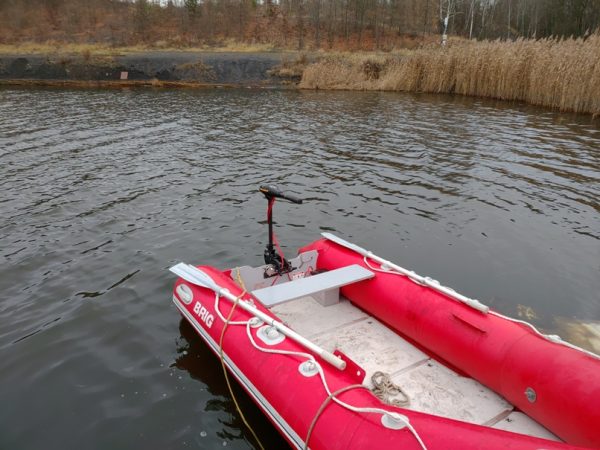
photo by Bartosz Łozowski
INDUSTRIAL WATERS OF THE NURSERY FARM “KRÓLÓWKA”
KOBIÓR
Analysis of the quality of industrial water of the Nursery Farm “Królówka” in Kobiór in terms of dwarfing of seedlings – ”State Forests” National Forest Holding Forest Inspectorate Kobiór – 2019
The aim of the study was to analyse the quality of water from two own deep wells of the Nursery Farm, used in the “Królówka” forestry container nursery for watering seedlings. On the basis of the analyses, the cause of the dwarfing of seedlings was indicated and corrective measures were proposed.
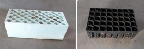
Polystyrene (1) and polyolefin (2) containers for the production of seedlings in container nurseries
photo by Marcin Libera
Retention reservoirs for industrial water with a capacity of about 30 m3
photo by Marcin Libera
POGORIA III RESERVOIR
DĄBROWA GÓRNICZA MUNICIPALITY
Analysis of the condition and development of recommendations for the management of the Pogoria III water reservoir – Dąbrowa Górnicza Municipality – 2019.
The subject of the study was the assessment of the condition of the Pogoria III reservoir made on the basis of research, field study, and laboratory analyses. The works were undertaken in order to diagnose the causes of the deteriorating water quality in the reservoir as indicated by the results of measurements conducted by the Provincial Environmental Protection Inspectorate in Katowice for the bathing beach, according to the information obtained from the Principal. The research included bathymetric and physicochemical measurements made from the surface of the reservoir with the use of floating equipment and a review of available historical data. The measurement results reflect the water condition on the measurement day. Understanding the variability of water quality and assessment of the processes taking place in the reservoir will require the analysis of data from at least the full hydrological year, taking into account meteorological conditions such as rainfall, temperature, wind direction, and strength as well as direct anthropogenic factors.
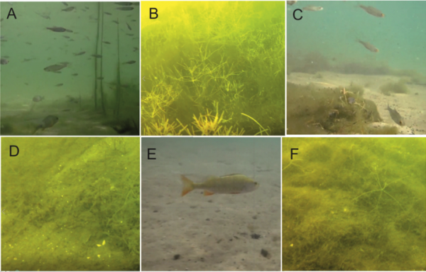
Images of the reservoir bottom taken in 2016 (A, C, E) and in 2019 (B, D, F)
photo by Robert Wiśniewski
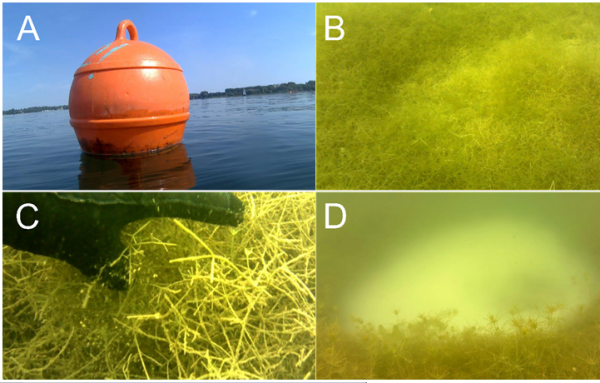
The image of submerged vegetation was recorded in the area of the fishing buoy. A – buoy on the surface of the water; B – fields of dead submerged vegetation; C – decaying plant debris; D – barren area in a field of submerged vegetation
photo by Robert Wiśniewski
RESERVOIRS OF THE LEMNA WASTEWATER TREATMENT PLANT
KOCHCICE
Analysis of the condition of the resevoirs in the Lemna wastewater treatment plant in Kochcice – Browarski Roman “HYDROTECH” Zakład Ochrony Środowiska
The aim of the research was to determine the model of the reservoir bowl of the wastewater treatment plant in Kochcice, the analysis of the thickness of bottom sediments, and the large-scale analysis of the physicochemical parameters of the waters of these reservoirs. Two water reservoirs of the Lemna 1 and Lemna 2 wastewater treatment plants in Kochcice were analysed. Additionally, selected physicochemical parameters of the waters flowing into the Kochcice stream were analysed with a multi-parameter probe.
Photos of the Kochcice stream outflow from the Ludwik pond, hydrotechnical devices
photo by Marcin Libera
Compost heap
photo by Marcin Libera
SEDIMENT FIELD IN CHUCHUŁKA HAMLET
PSZCZYNA
Study of the thickness of the sediments deposited in the sediment field located in the hamlet of Chuchułka in Pszczyna – Górnośląskie Przedsiębiorstwo Wodociągów SA in Katowice
The aim of the study was to determine the degree of terrestrialisation of the sedimentary fields, the Chuchułka sedimentation reservoir for technological sediments from the Water Treatment Plant in Goczałkowice and the forecast time of its complete terrestrialisation.
Area of Chuchułka sedimentation basin free from terrestrialisation
photo by Marcin Libera, Andrzej Woźnica
Partially terrestrialised area of Chuchułka sedimentation basin
photo by Marcin Libera, Andrzej Woźnica
GOCZAŁKOWICE RESERVOIR
Development of a report on the condition of groundwater around the Goczałkowice Reservoir (“Quantitative Report”), 12 monthly reports to assess the quality of surface waters (“Quality Reports”), and a report on the spatial variability of the waters of the Goczałkowice Reservoir (“Report on Variability”) – Górnośląskie Przedsiębiorstwo Wodociągów SA in Katowice – 2019-2020
Groundwater monitoring was carried out with the use of piezometers of the monitoring network established as part of the ZiZOZap project. Groundwater monitoring included quantitative and qualitative research on groundwater. As part of the qualitative monitoring, chemical composition and quality tests were performed in the scope of the analysis of unstable parameters (temperature, pH, EC, Eh) and in the scope of the most common pollution indicators (nitrogen compounds, phosphates, chlorides, sulphates)..
The report was prepared on the basis of continuous and patrol monitoring of surface waters. Continuous monitoring sets the trend of modern water quality measurement methodology. Continuous monitoring of the physical and chemical parameters of water allowed to show the dynamics of the observed indicators, not only seasonal but also diurnal.
A large-scale analysis of the waters of the Goczałkowice reservoir was carried out, i.e. a physicochemical spatial analysis of the reservoir including the following parameters: temperature, pH, dissolved oxygen, conductivity, turbidity, salinity, and Secchi disc visibility. Statistical analysis of the distribution of parameters in the area of the reservoir using the kriging method and the selection of possible endangered areas was used to prepare a 3D map of the physicochemical variability of the waters of the Goczałkowice Reservoir.
Measurements of water quality in the Goczałkowicki Reservoir
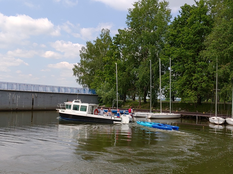
photo by Bartosz Łozowski
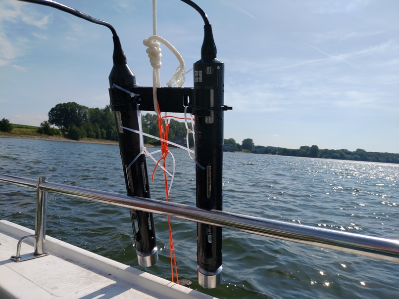
photo by Bartosz Łozowski
PIŃCZOWSKI RESERVOIR
PIŃCZÓW MUNICIPALITY
Development of assumptions for the implementation of the project of integrated management of the Pińczów Reservoir along with the definition of proposed activities for the protection of freshwater mussels living in the reservoir – Pińczów Municipality
The development of the report, which is also a proposal of actions for the rational management of the Pińczów reservoir in order to improve and maintain the water condition and the reservoir water environment, was carried out on the initiative of the mayor of the city of Pińczów, in connection with the challenges arising from the desire to maintain recreational and natural functions, especially in the context of freshwater mussels living in the reservoir. The report was prepared based on the data collected in the field, the information provided verbally, and materials from the Regional Directorate for Environmental Protection in Kielce, regarding the mass death of freshwater mussels in the Pińczów Reservoir in 2018. Field studies were carried out to identify hotpoints that may indicate the causes of the extinction of mussels from the Unionidae family. Based on the analyses, it was proposed to conduct a series of studies aimed at creating a reservoir management plan.
2018
ROGOŹNIK I RESERVOIR
BOBROWNIKI MUNICIPALITY
Comprehensive analysis of the condition of the Rogoźnik I reservoir with the presentation of corrective proposals – 3 stages – Bobrowniki Municipality – 2018
The scope of the performed research work included:
- developing a numerical model of the Rogoźnik I reservoir bowl on the basis of bathymetric measurements and analysis of the reservoir’s hydrotechnical documents;
- performing qualitative and quantitative analyses of sediments with spatial distribution in the Rogoźnik I reservoir bowl (sediment morphology);
- determining the surface waters catchment on the numerical terrain model, determination of the location of pollution sources in the Rogoźnik I catchment;
- determining the location of potential sources of contamination of the Rogoźniki I reservoir on the basis of an analysis of direct inflows and pressure on the reservoir;
- developing the species and age structure of fish in the Rogoźniki I reservoir on the basis of electrofishing and analysis of The Polish Angling Association or other available documentation, determination of fish food base – zoobenthos;
- performing a qualitative and quantitative inventory of the vegetation of the Rogoźniki I reservoir and its direct catchment, estimating the remediation potential of rush vegetation, determining the favourable location and size of the rushes areas of the Rogoźniki I reservoir;
- developing maps of the Rogoźniki I reservoir containing physicochemical parameters in a regular grid based on the analysis of physicochemical parameters of inflows;
- developing recommendations and guidelines for reclamation, taking into account various solutions as agreed with the Ordering Party, with an assessment of potential effects – DPSIR analysis (Driving Forces-Pressures-State-Impact-Responses);
- developing a mathematical model of the Rogoźniki I reservoir (AEM3D) with options for testing event scenarios related to solutions introduced to the reservoir in the scope of planned reclamation.
Preparation of measurement sets on the Rogoźnik I reservoir
photo by Bartosz Łozowski
Bathymetric measurements on the Rogoźnik I reservoir
photo by Bartosz Łozowski