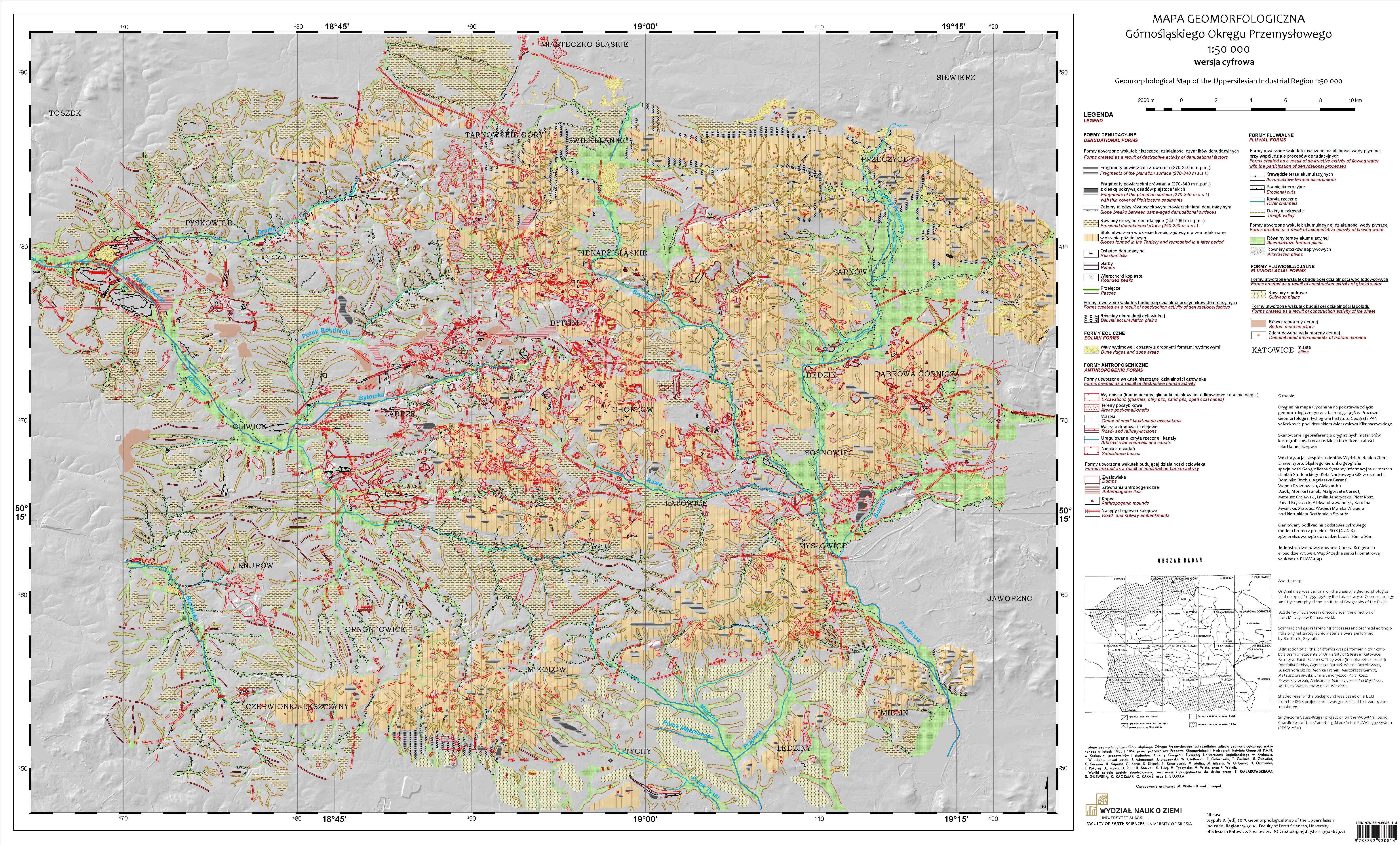
The paper is a brief description which discusses the stages of the digital adaptation of the printed version of Geomorphological map of GOP 1:50,000 from 1959. It was paid attention to difficulties and errors that arose during the work (incompatibility adjacent sheets, problems with distinguishing or lack of some landforms, no coordinate system). As a result, a geodatabase with 30 vector layers was obtained depicting all relief forms which appearing on the original map. The uniqueness of this map arise due to anthropogenic relief forms placed on it because the surface of the mapped area was very strongly transformed by economic human activity. It was decided to compare recorded anthropogenic landforms with other periods (1890, 1993, 2014). As a result, it was possible to trace they spatial and quantitative changes. In general, between 1890 and 2014, all anthropogenic forms increased by 25-1000%, this caused a internal structure change (many large forms appeared). Currently the most common forms are anthropogenic flats.


