Go to main content

University of Silesia in Katowice

  • Polski
  • English
Institute of Earth Sciences
Logo European City of Science 2024

Bytom – the city that is sinking

19.05.2022 - 14:37 update 19.05.2022 - 14:41
Editors: lukaszmalarzewski

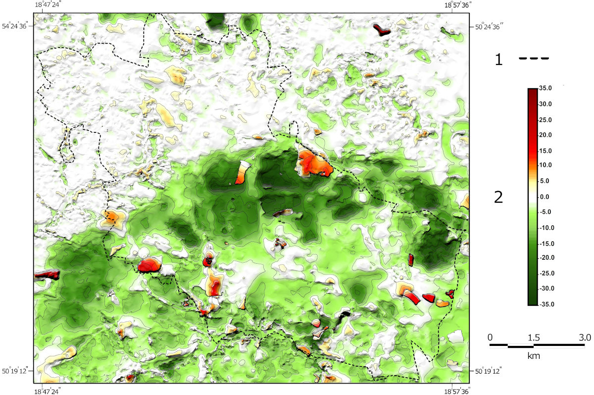
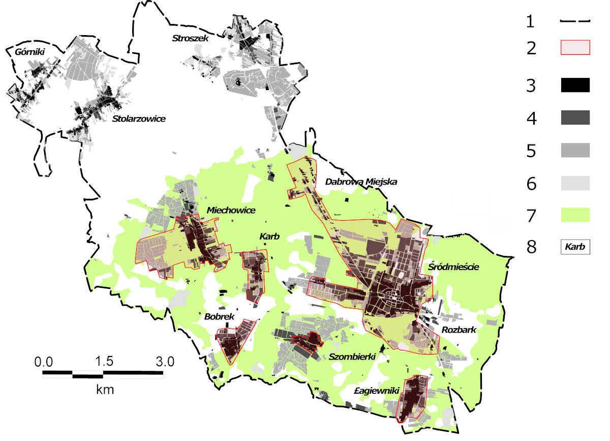
An article by dr Maksymilian Solarski (IGSEiGP), dr Robert  Machowski,  prof. Mariusz  Rzętała and dr hab. Martyna A. Rzętała (INoZ) concerning changes in the hypsometry in the area of Bytom in the period 1883-2011 was published in Scientific Reports journal.  On the basis of the developed terrain models, the authors concluded that as a result of long-term mining activity in the city, the terrain was significantly transformed. The consequence of underground mining was the formation of extensive subsidence basins and dumps, which contributed to an increase in relative heights and intensity of the relief. During the analyzed period, the city area decreased by an average of 5.5 meters (a maximum of about 35 meters). Mining damage was also a consequence of land subsidence, which manifested itself primarily as damage to the structure of buildings. The research shows that almost 68% of the built-up areas (until 2011) were covered by land subsidence.

Solarski, M., Machowski, R., Rzetala, M. et al. Hypsometric changes in urban areas resulting from multiple years of mining activity. Sci Rep 12, 2982 (2022). https://doi.org/10.1038/s41598-022-06847-8
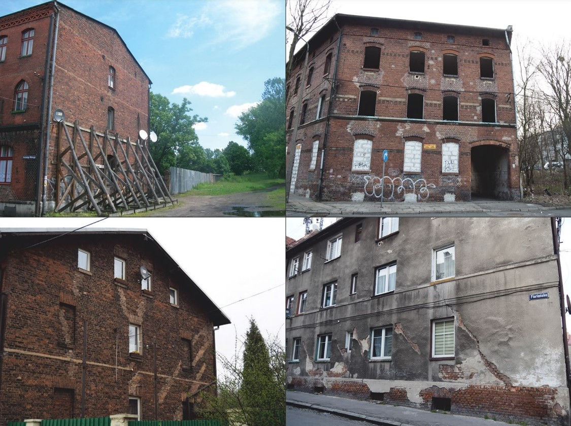
Examples of damage to Bytom’s urban fabric as a consequence of land subsidence (photo: M. Solarski)
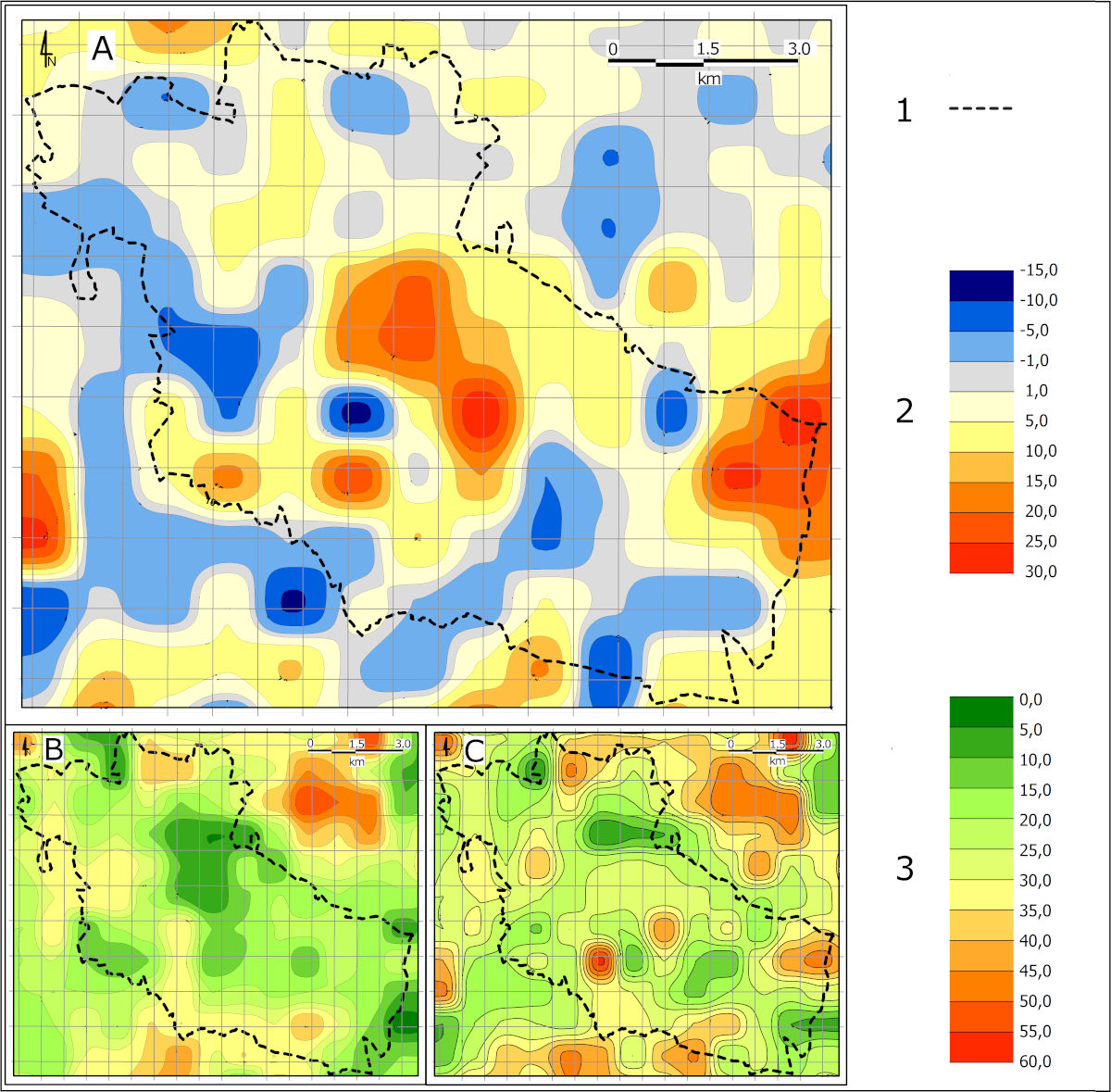
Changes in Bytom’s relief intensity in the nineteenth and twentieth centuries: A—changes in relative elevation from the late nineteenth century to the late twentieth century; B—variation in relative elevation in the late nineteenth century; C—variation in relative elevation in the late twentieth century; 1—city boundary; 2—magnitude of change in relative elevation from the late nineteenth century to the late twentieth century; 3—variation in relative elevation from the late nineteenth century to the late twentieth century.
Changes in relative elevation within Bytom between 1883 and 1994: 1—city boundary; 2—elevation changes
Land subsidence in the Bytom area in the years 1883–2011: 1—contemporary city limits; 2—built-up areas where mining damage and demolitions occurred; 3—built-up areas (as at 1883); 4—built-up areas (as at 1934); 5—built-up areas (as at 1994); 6—built-up areas (as at 2011); 7—range of land subsidence in the period 1883–2011; 8—city districts.
return to top