Go to main content

University of Silesia in Katowice

  • Polski
  • English
Institute of Earth Sciences
Logo European City of Science 2024

Airborne laser scanning and its usefulness in past landscape reconstruction in the Western Beskids.

30.05.2023 - 12:10 update 30.05.2023 - 12:15
Editors: lukaszmalarzewski

Until now, mainly series of consecutive historical maps and aerial photographs have been used in research on landscape changes. However, some authors have drawn attention to the need to verify the content of archival maps as they are often burdened with errors. There has been the possibility to verify the content of historical maps in new ways over the past 20 years, such as airborne laser scanning (ALS).As varied techniques of DEM visualization are applied to identify landscape elements connected with past human activity, they provide different results in the detection of landscape elements. Hence, there is a need to assess their usefulness.

The conducted study by PhD Michał Sobala, member of the Landscape Research Team,  shows that there is no possibility to point out the most useful DEM visualisation techniques for detecting anthropogenic terrain forms and objects connected with past human activity in marginal mountain areas. The average usefulness of applying particular DEM visualisation techniques does not differ significantly; however, this effectiveness varies slightly in different topography and land cover conditions. Furthermore, this study proved that in marginal mountain areas characterised by secondary forest succession, only DEM visualisation techniques provide the possibility to measure the length of detected embankments of agricultural terraces and balks on abandoned land. Measurement during feld mapping is impossible due to dense vegetation cover. On the contrary, the study proved the minor usefulness of DEM visualisation techniques in the detection of point terrain forms such as stone mounds. It was impossible to detect these forms using the DEM visualisation techniques in most cases. This is connected with the varied size of these forms; only the biggest forms were visible in DEM.

Although data from airborne laser scanning do not give a full picture of all existing forms and objects, they definitely facilitate their identification – especially in hard-to-reach mountainous terrain. Thus, they shed new light on the intensity of past human impact on the environment in the Western Beskids.

The research was financed by the Small Project from the Reserve of the Director of the Institute of Earth Sciences entitled “Usefulness of selected methods of visualization of airborne laser scanning data for the inventory of anthropogenic landforms related to the former use of marginal mountain areas”.

Reference:

https://doi.org/10.1007/s12520-023-01750-3
http://www.michalsobala.pl

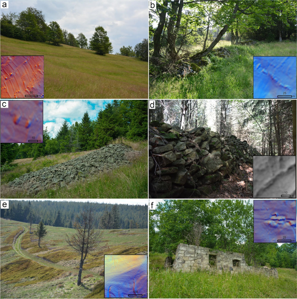
Terrain forms and objects related to past agricultural land use in glades in the Western Carpathians. Photographs and DEM visualisation present: a embankments of agricultural terraces in Praszywka, b balk in Praszywka, c stone mound in Prusów, d stone wall in Ostre, e road in Radziechowska, f remains of a residential building in Prusów. DEM visualisation techniques applied: MHS: a–c, e–f, SVF: d (photograph by Michał Sobala)
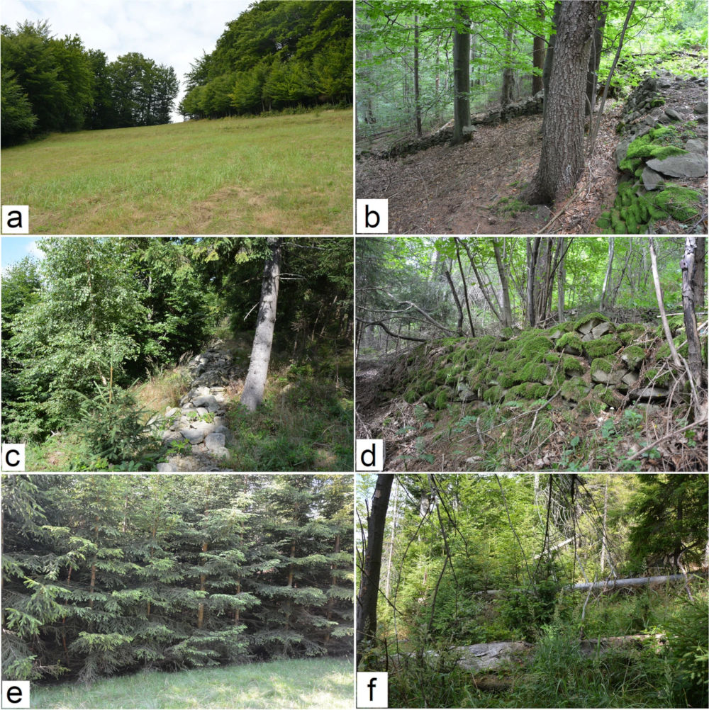
Location of selected linear terrain forms according to land cover: a embankments of agricultural terraces in areas covered with grasses did not cause a problem during feld mapping (Prusów), b stone walls edging past arable felds in a forest where measurement was possible (Ostre), c stone wall emerging form forest that could be measured only partially (Prusów), d stone wall that could be detected, but its measurement was impossible due to tree cover (Ostre), e spruce bosk that made measurement of linear forms during feld mapping impossible (Praszywka), f dense forest vegetation with downed trunk making measurement of linear forms during feld mapping impossible (Prusów). (photograph by Michał Sobala)
return to top