Go to main content

University of Silesia in Katowice

  • Polski
  • English
Institute of Earth Sciences
Logo European City of Science 2024

Anthropogenic landforms derived from LiDAR data in the woodlands near Kotlarnia (Koźle Basin, Poland)

05.09.2023 - 09:21 update 05.09.2023 - 09:28
Editors: lukaszmalarzewski

Until recently, forests were regarded as areas favourable to the preservation of historical sites, settlement relics, traces of human economic activity or war events. From the archaeological point of view, they were even treated as terra incognita. Unfortunately, due to the increased use of invasive methods in these areas (mainly preparing the soil for new planting, but also implementing large investment projects or digging large open-cast mines), woodlands have ceased to be safe places for the relics of human activity recorded in the relief of the land. A group of geomorphologists from the Institute of Earth Sciences: Jan Maciej Waga, Bartłomiej Szypuła, Maria Fajer and sedimentologist Kazimierz Sendobry, analysed the shaded images of a 37-hectare woodland area near Kotlarnia. The study distinguished landforms of various ages documenting 21 different human activities that were identified, including remnants of reforestation activities, the expansion and modification of hydraulic structures and road infrastructure, charcoal burning and tar distilling, exploitation of mineral resources and military activities. The results of the remote sensing works were verified in the field. Nowadays, political and economic decisions concerning forestry may—and should—take into account both economic considerations and issues related to protecting and documenting the heritage recorded in the relief of forest areas. Woodlands are particularly important in this context, since such a wealth of natural and man-made forms, which can be revealed by laser scanning, is not found in agricultural or urban areas.

This research was funded from “Małe Projekty 2022” financed from the
reserve of the Institute of Earth Sciences Director.

Reference: https://doi.org/10.3390/s22218328

Note author: Professor Maria Fajer
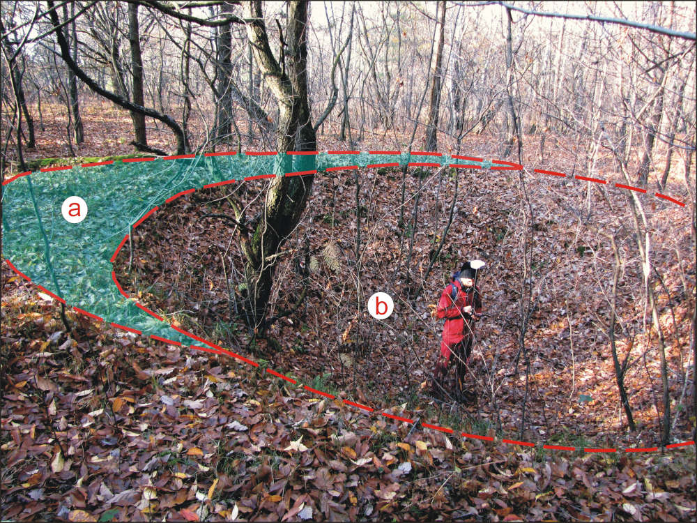
. Remnants of a charcoal pile partially destroyed by a bomb explosion during World War II: (a) charcoal pile remnants; (b) bomb crater (photo: J.M. Waga).
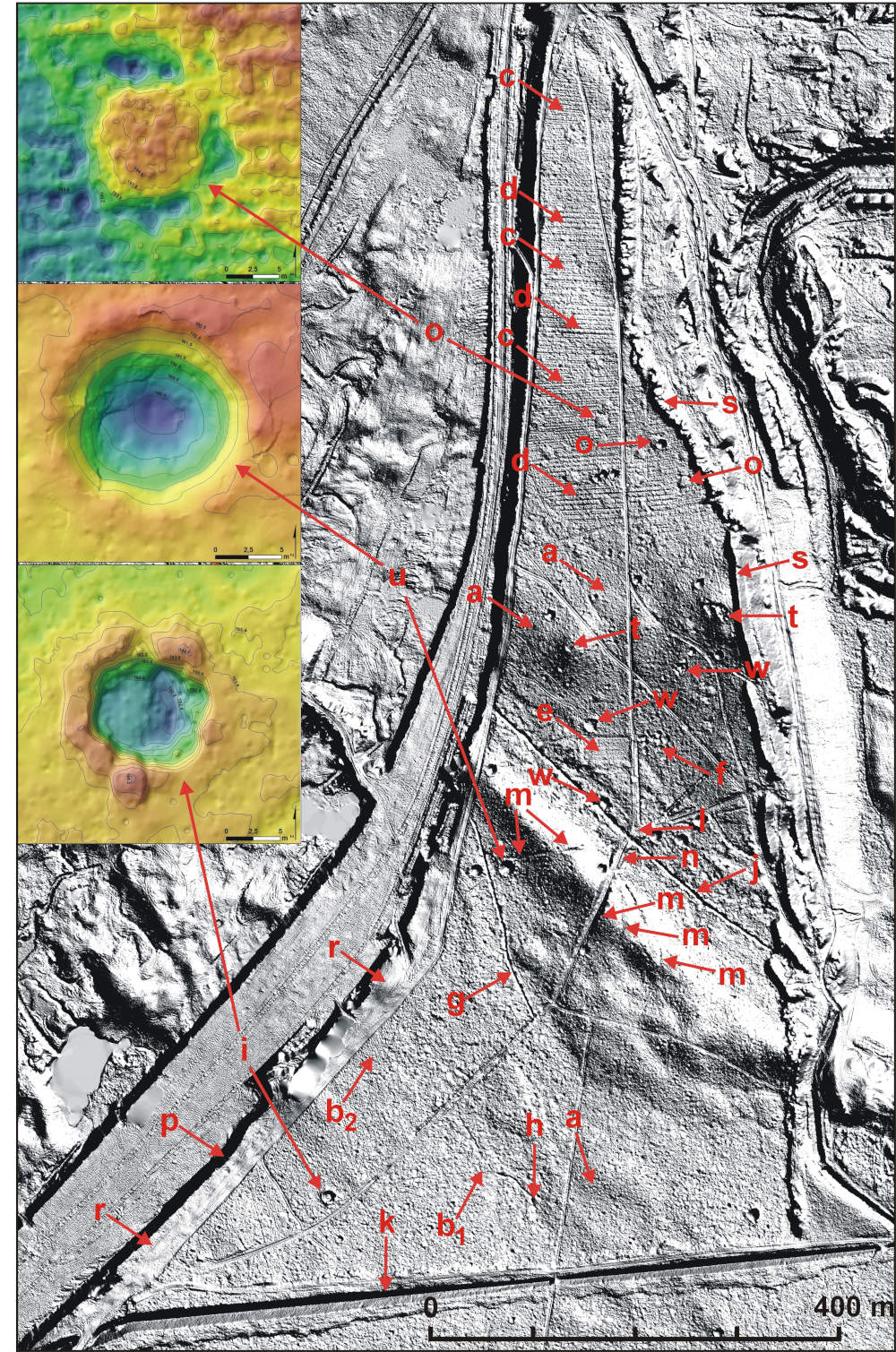
Study area: (a) forest area cultivated using the traditional no-till method around 100 years ago; (b) traces of shallow forest tillage from (b1) 80 and (b2) 55 years ago; (c) traces of deep tillage from 30 years ago; (d) traces of deep tillage from 30 years ago—deeper furrows breaking the hardpan; (e) mid-forest plot; (f) dugout complex; (g) drainage ditch; (h) spring niche or bog-spring; (i) bomb crater with a central peak; (j) dry stream bed; (k) deep ditch surrounding the sand pit; (l) forest road junction; (m) incision with a forest road; (n) road embankment; (o) charcoal pile remnants; (p) sand mine working wall; (r) strip with humus removed, prepared for sand excavation; (s) pile of humus overburden; (t) gravel extraction sites; (u) crater left by the concentric explosion of two bombs; (w) crater remodelled by human activity.
return to top