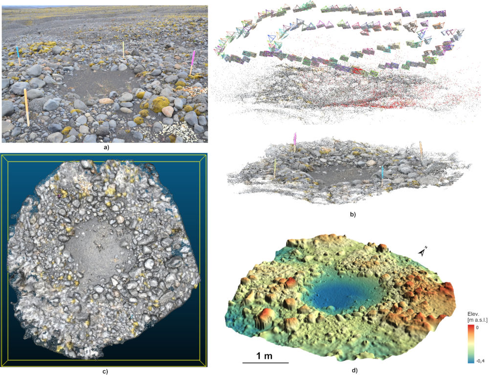
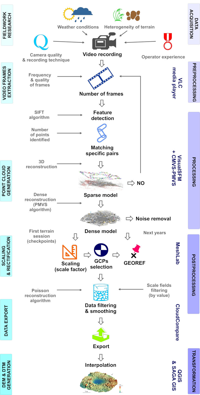
To obtain high-resolution digital elevation models, the so-called DEMs, all you need is a camera, simple measurements and free software (fig. 1). Thanks to the use of the Structure from Motion photogrammetric technique, a very accurate model can be obtained with a raster field size of only 5 cm × 5 cm. Dr Joanna Szafraniec from our Institute used this technique to map over 80 kettle holes of glacial flood origin on the Skeiðarársandur outwash in southern Iceland. The obtained DEMs and supporting material were published in the open international repository Zenodo. The content of the data package, its structure and the method used (fig. 2) are described in a publication that appeared in June 2024 in “Scientific Data”.
The obtained digital elevation model is characterized by very high accuracy. The average horizontal error is only ± 2.2–3.2 cm, and the vertical error is only ± 0.2–0.4 cm. It was estimated that the optimal resolution of 5 cm for DEM can be obtained for depressions with a capacity of up to approximately 4000 m3. The described method of obtaining data and analyzing changes in relief over time is widely used in geomorphology and many other fields of science. Due to its low costs, it can also be an excellent alternative for students and young researchers.
The research was financed by the National Science Centre Miniatura 5 project, no. 2021/05/X/ST10/00710 “Development of a high-resolution digital elevation model (DEM) of kettle holes of glacial flood origin on Skeiðarársandur (S Iceland)” and with the support of the Director of the Institute of Earth Sciences of the University of Silesia in Katowice. Research activities were also supported by funds allocated under the Research Excellence Initiative IV University of Silesia in Katowice.
Source: Szafraniec J.E. 2024. A dataset of high-resolution digital elevation models of the Skeiðarársandur kettle holes, Southern Iceland. Sci Data 11, 660. https://doi.org/10.1038/s41597-024-03515-6.
Author: Dr Joanna E. Szafraniec


