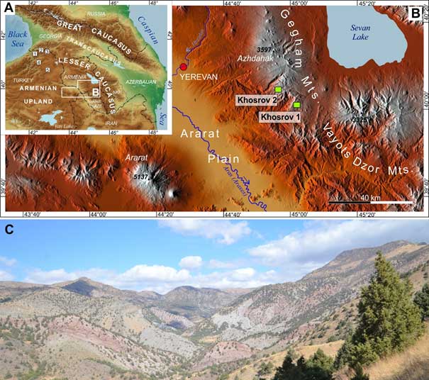
The Armenian Plateau, located between the Black Sea and the Caspian Sea, is an area sensitive to modern climate changes. Due to the intensification of droughts in this region, the reconstruction of rainfall conditions is very important. During the field research, cores from oaks and junipers were collected and subjected to dendrochronological analyzes consisting of measuring the width of the growth ring, the isotope ratio of 18O / 16O, and changes in the anatomy of the wood. Their result was the creation of the first chronologies for this region, which provides the basis for further research on the reconstruction of hydroclimatic conditions. Research conducted by dr hab. prof. UŚ Magdalena Opała-Owczarek from our institute, together with a team of geographers from the Universities in Yerevan and Wrocław, indicate that contemporary climate change increases drought stress, which has negative consequences for the semi-arid ecosystems of the Southern Caucasus. The obtained research results became the basis for starting scientific cooperation with the Armenian Academy of Sciences.
The research was financed by the project of the National Science Center MINIATURA: Analysis of the width, anatomy, and isotopic composition of annual increments of Quercus pontica as a source of information on climate changes in the Lesser Caucasus in recent centuries.
Opała-Owczarek, M; Galstyan, H; Owczarek, P; Sayadyan, H; Vardanyan, T
Dendrochronological potential of drought-sensitive tree stands in Armenia for the hydroclimate reconstruction of the Lesser Caucasus. Atmosphere, 12 (2), pp. 1-15, 2021, doi:10.3390/atmos12020153

Fig. 1. Location of the Armenian Plateau and the Lesser Caucasus region between the Black Sea and the Caspian Sea showing the location of previously published chronologies (1), and new sampling sites in Gegham Mountians (B). General view of the study area covered with open woodlands dominated by juniper trees (C).


